Never Forget Where Your Photos Were Taken
Automatically stamp every photo with GPS coordinates, address, and time. Explore the world virtually with Street View, 3D maps, and live location feeds – all in one powerful app.
Everything you need for location-perfect photography
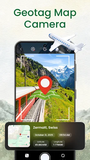
Smart Photo Geotagging
Every photo automatically captures GPS coordinates, address, timestamp, and map overlay. Perfect for work documentation, travel memories, or field surveys – no manual entry required.
Virtual Exploration Tools
Walk through any street with 360° Street View, preview destinations before visiting, and explore famous landmarks worldwide. Plan smarter trips and discover new places from your phone.
Professional Measurement Features
Measure distances, areas, and heights directly on the map with point-to-point accuracy. View locations in immersive 3D and access real-time air quality data for any place.
All-in-One Location Suite
Replace multiple apps with one complete solution. Get GPS camera, Live Earth feeds, 3D maps, Street View, and location tools together – everything you need to document and explore.
📸 GPS Map Camera & Geotag Photo – Capture Photos With Accurate Location Data! 🌍
Want to take photos with precise GPS coordinates? Or explore places with Street View right from your phone?
GPS Map Camera & Geotag Photo gives you a powerful combination of GPS, mapping, and camera tools in one smart, easy-to-use app.
📸 GPS Camera – Auto Geotag Photos with Coordinates, Time & Address
Automatically add GPS coordinates (latitude & longitude), address, timestamp, and map overlay to every photo. Perfect for travel, fieldwork, surveys, documentation, or adventure logs.
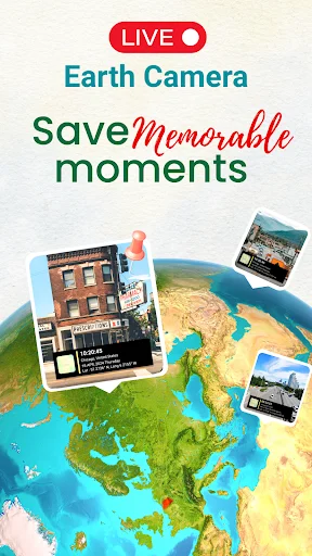
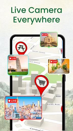
🛰️ Live Earth Camera
Watch a specific location in real time through a live camera feed that continuously shows what is happening at that place
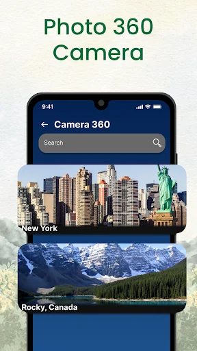
🚶♂️360° Street View Camera
Explore Any Place Like You're There. Walk virtually through streets, check routes, revisit familiar spots, or explore new locations before visiting.
🌍 3D Maps & World View
Zoom, rotate, and view landscapes, buildings, and terrains in immersive 3D.
📏 Measure Tool – Distance & Area Measurement
Measure distance, area, or height directly on the map with simple point-to-point accuracy.
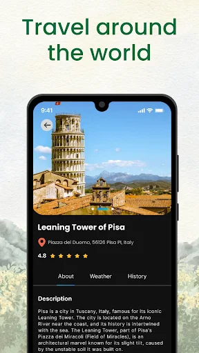
⭐ Famous Places – Discover Iconic Locations Worldwide
Quickly explore curated collections of famous landmarks, tourist spots, natural wonders, and must-see destinations. Jump to any landmark instantly using satellite view, Street View, or 3D mode.
🌫️ Air Quality Index & Local Time Info
Instant updates on AQI and local time for any selected location.
With GPS Camera, 3D maps, Street View, navigation, and real-time geolocation, GPS Map Camera & Geotag Photo turns your phone into the ultimate travel and documentation companion. 👉 Download now and make every photo a meaningful location record!
See how easy location-perfect photos can be
Loved by travelers and professionals worldwide
good morning call pick 👌
great work application